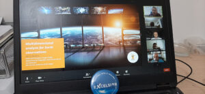
EXCELSIOR met the Ben-Gurion University of the Negev, The Earth and Planetary Image Facility
On 17th of June 2020, EXCELSIOR and the Ben-Gurion University of the Negev, The Earth and Planetary Image Facility organized an online event from 11.00 am to 12.30. During the event, Professor Diofantos Hadjimitsis the Coordinator of the Excelsior #H2020 presented the “EXCELSIOR” project and the Eratosthenes Centre of Excellence.


The Agenda
1. Introduction by Prof. Diofantos Hadjimitsis and Prof. Dan Blumberg
2. Presentation of the Excelsior H2020 and the Eratosthenes Centre of Excellence by Prof. Diofantos Hadjimitsis
3. Presentation of the Ben-Gurion University of the Negev and The Earth and Planetary Image Facility by
Professor Dan G. Blumberg
Vice President for Regional and Industrial Development & Head of the Earth and Planetary Facility
4. Presentation of the Letter of Commitment of Ben-Gurion University to Excelsior by Prof. Hadjimitsis and Prof. Blumberg
5. Open Discussion with the partners of the Excelsior H2020 Project and Ben-Gurion University (Mr Gunter Schreier from DLR, Dr Johannes Buehl & Dr Patric Seifert from Tropos, Prof Blumberg & Dr Shimrit Maman from Ben-Gurion University, Prof. Hadjimitsis, Dr Themistocleous, Dr Michaelides, Dr Tzouvaras, Dr Polydorou and Dr Mammouri from CUT)
6. Remarks
Ben-Gurion University of the Negev is one of the strategic commited organisations of #excelsior2020.eu and #EratosthenesCentreofExcellence!


✍🏻✍🏻✍🏻✍🏻✍🏻
The Earth and Planetary Image Facility is a multi-disciplinary laboratory located in the Department of Geography and Environmental Development at the Ben-Gurion University of the Negev. Our research focuses on the use of remote sensing for a variety of applications and on advancing the development of currently available remote sensing methods. The students in the laboratory come from a variety of academic backgrounds, including geography, electro-optics, geology, electrical engineering, bio-medical engineering, computer sciences, and agriculture.
The laboratory is affiliated with NASA’s Regional Planetary Image Facilities program and hosts an active archive of maps and remotely sensed images from the Solar System

