The deployment of state-of-the-art infrastructure will enable the ERATOSTHENES CoE to conduct cutting edge research in all the thematic areas identified by ERATOSTHENES CoE as well as provide the competitive advantage required to conduct innovative and integrated basic and applied research. The availability of this state-of-the-art infrastructure in all relevant areas will provide additional research opportunities to the ERATOSTHENES CoE.
During RP3, infrastructure activities for the ERATOSTHENES CoE focused on the procurement procedures, contracting, receiving, installing, and operating of the strategic equipment and state-of-the-art infrastructure, such as the Ground-based Remote Sensing station (GBS), the Satellite Data Acquisition Station (DAS), the Solar infrastructure equipment, the computing infrastructure of the Center, the equipment for the Agriculture sector and the Geodetic equipment. In addition, tender procedures for the acquisition of personal laptops, monitors and computing desktops were finalized in order to ensure the smooth operation of the Centre. Moreover, ERATOSTHENES CoE’s infrastructure department has undertaken all the necessary processes to deliver a new building through CUT’s commitment, in order to cover ERATOSTHENES CoE’s increasing needs.
Ground-based Remote Sensing station (GBS)
The infrastructures of the ERATOSTHENES CoE include a series of comprehensive suites of the strategic and state-of-the-art infrastructures. These capabilities enable the ECoE to conduct innovative and cutting-edge research. This wide range of resources to conduct research on Earth’s climate are categorized by:
- Ground-based Remote Sensing station (GBS)
- Satellite Data Acquisition Station (DAS)
- Science data products
- Modeling
- Computing resources
- Agriculture sector and Geodetic equipment.
In the context of the EXCELSIOR project, the ERATOSTHENES Centre of Excellence (ECoE) has acquired a series of high-quality instruments to obtain long-term measurements of cloud and aerosol properties, precipitation, and related atmospheric characteristics in diverse climate regimes of Cyprus. The Atmospheric Cluster of the Department of Climate and Environment of the ECoE coordinates the Cyprus Atmospheric Remote Sensing Observatory (CARO). CARO as a national facility consists of a multi-instrument platform that is unique with the latest modern standards and is only available in few regions globally.
A comprehensive suite of cutting-edge instrumentation is deployed at the CARO to measure clouds, aerosols, radiation, and their interactions. CARO is a National Facility (NF) for remote sensing of aerosol and clouds and planned to become a ACTRIS National Research Infrastructure facility for Cyprus consisting of the aerosol remote sensing (ARS) observational platform and the cloud remote sensing (CRS) observational platform. Located in the center of Limassol, Cyprus, CARO currently operates a multiwavelength Raman LiDAR PollyXT-Cyp for aerosol profiling, a scanning Doppler LiDAR for wind profiling and the sun/sky photometer of the Aerosol Robotic Network, a 35 GHz cloud radar, microwave radiometer, a disdrometer and a ceilometer.
CARO is one of the most advanced facilities placed in the EMMENA region with high interest on atmospheric composition structure.
The CARO’s instruments are continually in operation to obtain long-term measurements of cloud and aerosol properties, precipitation, and related atmospheric characterization in the region’s diverse climate regimes. The state of instrumentation of CARO as of October 2024, is illustrated in the following.
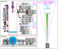
PollyXT
A multi-wavelength dual field of view Raman polarization Lidar >> Dual-FOV PollyXT
The Raman polarization lidar PollyXT-CYP, has been set up in Limassol at the ECoE-CARO premises for continuous operation under the EXCELSIOR project. This lidar has equipped with new state-of-the-art dual field of view technique and performing continuous recording from October 2020. The system is part of the Polly Network (PollyNET; pollynet.tropos.de) and the PollyXT-CYP lidar real-time observation can be accessed on the PollyNet website.
Doppler Radar
A 35-GHz scanning polarimetric cloud Doppler radar >> Mira-35
A meteorological Ka-Band cloud radar MIRA35 has been set up at the ECoE-CARO premises as a milestone to the establishment of the CARO national facility (CARO-NF). This radar was installed in cooperation with the remote sensing department of the Leibniz Institute for Tropospheric Research (TROPOS) and performs continuous recording since June 2024. Cloud radars are key devices of the ECoE-CARO GBS to determine the structure of clouds which cannot be penetrated by lidars. The MIRA35-CYP radar real-time observation can be accessed on the CLOUDNET portal.
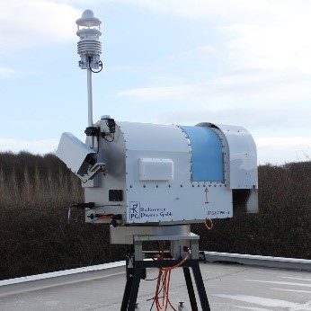
Doppler Lidar
A Streamline-XR Doppler lidar>> Snoopy
A Halo Streamline-XR doppler wind lidar has been set up at the ECoE-CARO ground-based station at Limassol since February 2023. The instrument performs vertical as well as scanning measurements. This wind dataset is vital to perform successful aerosol-cloud interaction studies based on the measurement conduct with upgraded aerosol-cloud lidar (Part A, B) in combination with a doppler lidar. Within the context of the ECoE-CARO observations, the doppler lidar will show the occurrence of gravity wave structures with a pronounced updraft period. The Snoopy-CYP doppler lidar real-time observation can be accessed here.

Ceilometer
A 1064-nm ceilometer >> CHM 15kx
A Ceilometer of type CHM 15k of Jenoptik company has been set up at the ECoE-CARO ground-based remote sensing laboratory from January 2024. Originally, ceilometers are used for the detection of the cloud base height, but they can also serve for determination of aerosol properties. Besides PollyXT, the ceilometer is a central part of Cloudnet to receive continuous information about the height of cloud and aerosol layers. The ECoE-CARO ceilometer real-time observation can be accessed on the CLOUDNET platform
Microwave Radiometer
A 14-channel microwave radiometer>> HATPRO G5
A high-precision microwave radiometer of type HATPRO G5 has been installed at the ECoE-CARO station from June 2024. As a passive instrument, this microwave radiometer (MWR) is used to measure several atmospheric quantities, such as the cloud liquid water path, column-integrated water vapor, cloud base height, brightness temperature as well as temperature and humidity profiles of the lower troposphere. The ECoE-CARO microwave radiometer HATPRO G5 real-time observation can be accessed on CLOUDNET platform
Disdrometer
An optical 1-d precipitation disdrometer>> PARSIVEL
A Parsivel disdrometer manufactured by OTT Hydromet Inc (Parsivel2) has been installed at the ECoE-CARO station since January 2024. Parsivel2 uses a 780 nm laser beam which is 180 mm long, 30 mm wide and 1 mm thick on average. Disdrometers (DD) measure the size distribution and falling velocity of precipitation at the surface. The measured drop size distribution is then used to derive the size distribution and reflectivity. The ECoE-CARO Parsivel real-time observation can be accessed through the CLOUDNET portal.
Sun-Photometer
A CUT-TEPAK AERONET Sun-photometer>> CUT-TEPAK CE318
Long-term aerosol observation has been operating by the CUT-TEPAK AERONET sunphotometer since 2010 at Limassol. This sunphotometer is now part of the ECoE-CARO ground-based station and it calculates base parameters of AERONET such as the optical thickness. Aerosol optical depth data are computed for three data quality levels: Level 1.0 (unscreened), Level 1.5 (cloud-screened), and Level 2.0 (cloud-screened and quality-assured). The CUT-TEPAK AERONET sunphotometer performs continuous recordings and its result can be accessed on the AERONET platform.
Ground-based Remote Sensing station (GBS)
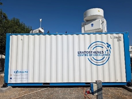
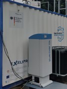
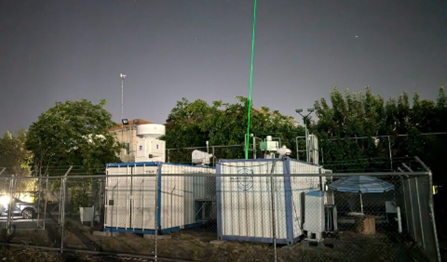
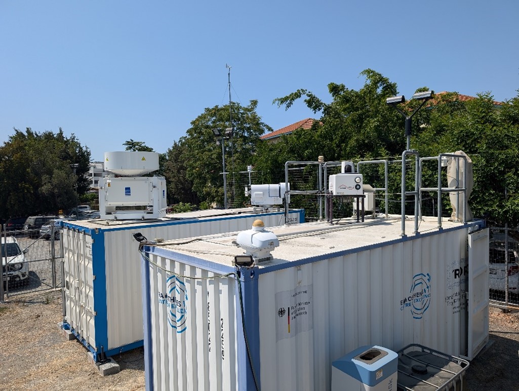
The ERATOSTHENES CoE has acquired through EXCELSIOR project a number of high-quality atmospheric instrumentation for aerosols, clouds and solar radiation measurements, in order to conduct research at the island of Cyprus. The atmospheric sector focused on the establishment of the ground-based atmospheric remote sensing station (GBS).
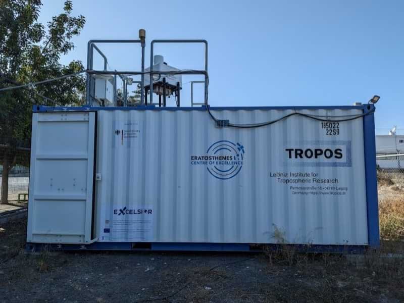
The GBS as part of the Cyprus Atmospheric Remote Sensing Observatory (CARO) National Facility (NF) consolidates the necessary infrastructure to set up the aerosol and cloud remote sensing observational platforms for continuous monitoring of aerosol and clouds providing ground truthing observations and a reference station for calibration/ validation of satellite missions. The research instruments are installed within two containers. Additionally, dedicated servers for the instruments control and data processing are installed in the containers, making the GBS independent from external needs, and ready to be deployed for campaign measurements outside Cyprus.
CARO is a National Facility (NF) for remote sensing of aerosol and clouds and planned to become a ACTRIS National Research Infrastructure facility for Cyprus consisting of the aerosol remote sensing (ARS) observational platform and the cloud remote sensing (CRS) observational platform. Located in the center of Limassol, Cyprus, CARO currently operates a multiwavelength Raman LiDAR PollyXT-Cyp for aerosol profiling, a scanning Doppler LiDAR for wind profiling and the sun/sky photometer of the Aerosol Robotic Network. During 2024, the CARO facility will operate a 35 GHz cloud radar, microwave radiometer, a disdrometer and a ceilometer. As soon as both observation platforms for aerosol and cloud vertical profiling are operational, CARO will become one of the most advanced facilities placed in the EMMENA region with high interest on atmospheric composition structure.
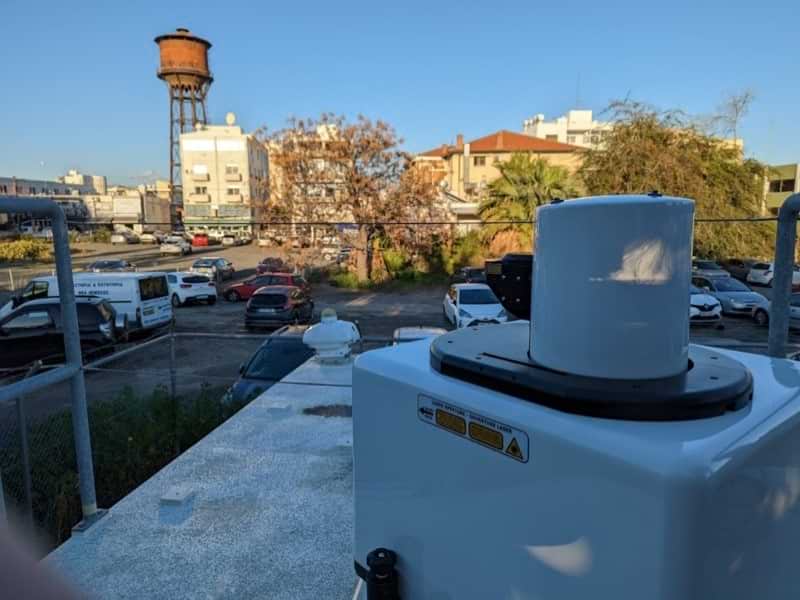
The aerosol remote sensing instruments of the GBS contributes to the GAW network in WMO Region VI – Europe as station 0-196-0-LIM. The station is situated in the centre of the city of Limassol and represents an urban Eastern Mediterranean European coastal site. Traffic and local dust emissions are major local sources. The station is located about 800m from the coastline of Limassol and at the North of the station in a distance of 30 km there is the Troodos Mountain (~2km height). The station is co-located with the TEPAK (0-196-0-01389) Meteorological station.
In addition to the aerosol and cloud remote sensing observational platforms, CARO includes a solar radiation station and the solar radiation network of ERATOSTHENES CoE. The energy sector is responsible for the establishment of the solar radiation stations which consists of state‐of‐the-art remote sensing facilities (solar spectroradiometers, photometers and broadband radiometers) operating fully automated 24/7.
Currently the PollyXT-CYP lidar real-time observation can be accessed on the PollyNet website.
The Doppler wind lidar measurements can be accessed on TROPOS data visualization portal. (this link works in http only, avoid https)
Sun-photometer observations are available on the AERONET webpage.
For access to the PollyXT-Cyp aerosol lidar obervations click here.
For access to the Snoopy Doppler wind lidar observations click here. (this link works in http only, avoid https)
For access to the sun-photometer observations click here.
The final component (cloud radar) delivery is scheduled for Q1 2024 and it will be installed in the delicate container at the TROPOS facility. After the final installation, the GBS station will be shipped to the ERATOSTHENES premises in Limassol.
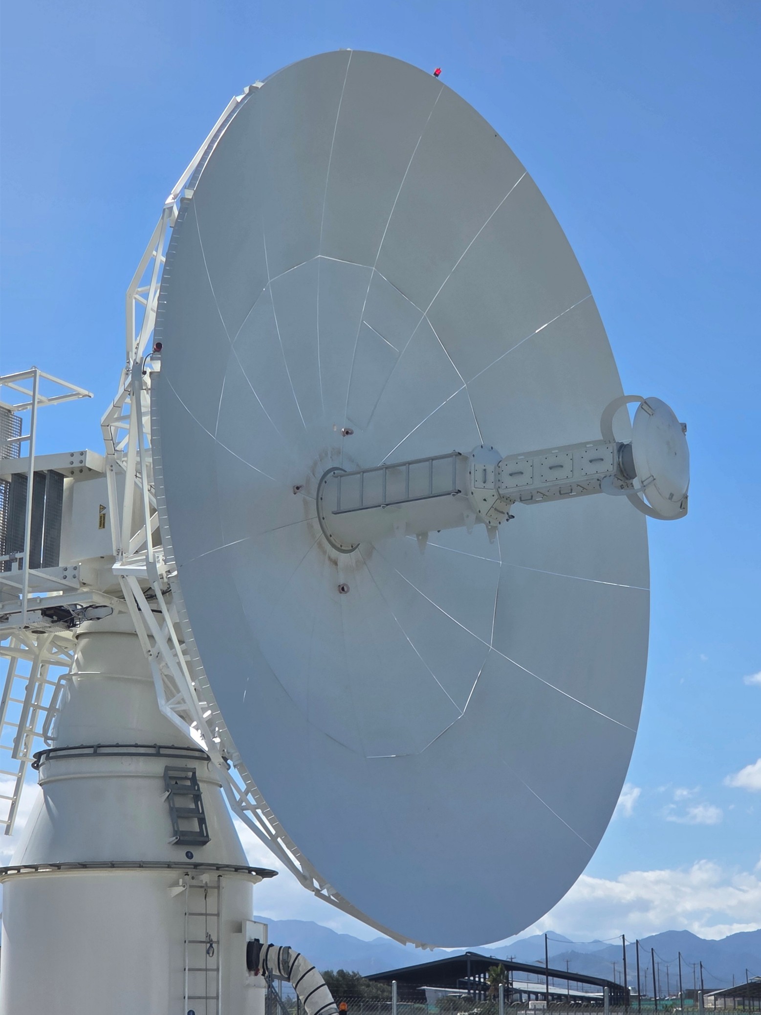
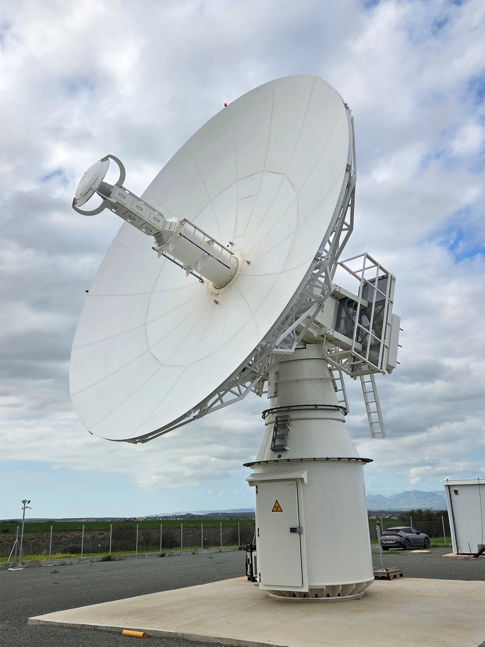
Earth Observation Satellite Data Acquisition Station Hosting (DAS)
The Eratosthenes Centre of Excellence, in partnership with Cyta, has launched the first Earth Observation Data Ground Station in Cyprus. Positioned at the crossroads of Europe, Asia, and Africa, Cyprus offers a strong geostrategic advantage and excellent weather conditions, making it an ideal location for Earth Observation services across the EMMENA region.
The ground station strengthens the Centre’s role as a regional hub for Earth Observation innovation, offering advanced TT&C, data downlink, dissemination, and processing capabilities. Its strategic location, combined with the expertise of the Centre’s partners and Cyta’s long-standing experience in international connectivity and teleport operations, creates a strong platform for global competitiveness. The Centre is actively engaging with international clients and participating in national and European tenders, supported by the technical capacity to meet demanding Service Level Agreements.
Key services include:
- Near real-time Earth Observation imaging and data acquisition services for commercial applications
- Hosting services, including mission control and five-band TT&C communications for international mission operators
- Leasing services, providing access to satellite data capacity through existing or customized downlinks
- Earth Observation imaging and research data for commercial and scientific use
The receiving station enables direct data reception from Earth Observation satellite missions within its coverage footprint. Equipped with a three-band feed, it can simultaneously receive S, X, and Ka bands, supporting a wide range of missions across the Mediterranean, Persian Gulf, Red Sea, Black Sea, and Caspian Sea regions.
Hosted at one of Cyta’s established teleports in Pera Oreinis, the station provides advanced facilities for data acquisition, processing, and storage for international customers. Secure data distribution is supported by Cyta’s extensive fibre network, which connects to major European and global hubs, enabling the delivery of high-quality services to international and national stakeholders.
As part of EXCELSIOR, this initiative is supported by the Government of Cyprus and international partners, including the German Aerospace Center, DLR. In February 2026, the ERATOSTHENES Centre of Excellence and Cyta established a joint venture to operate the receiving station, further expanding the Centre’s capabilities and service portfolio.
The Solar infrastructure equipment
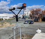
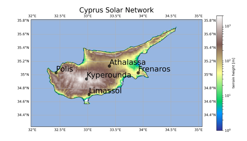
The Cyprus Solar Network (CSN) is a ground-based network consisting of five stations designed for monitoring solar energy and solar ultraviolet (UV) radiation. These stations have been strategically selected to cover different geographical areas within the Republic of Cyprus. The central station is located in Limassol, with the other four stations located in Polis Chrysohous, Kyperounta, Athalassa, and Frenaros (see map).
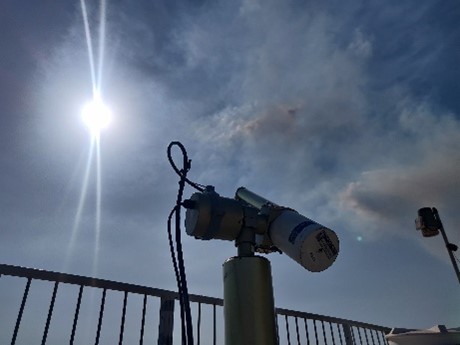
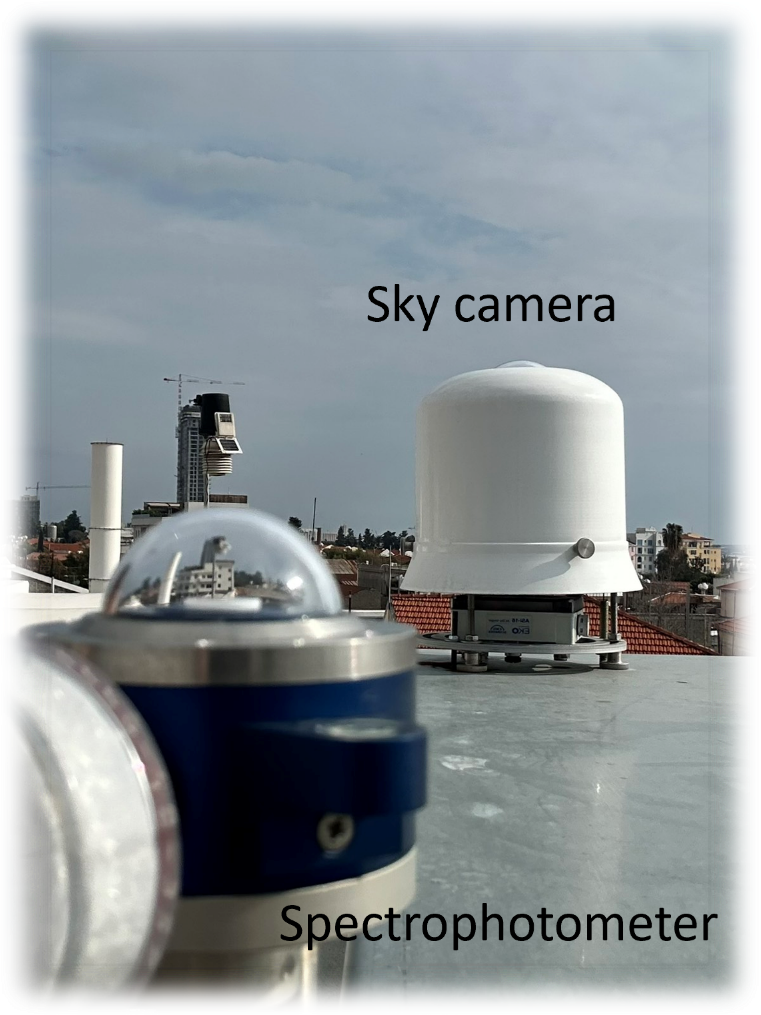
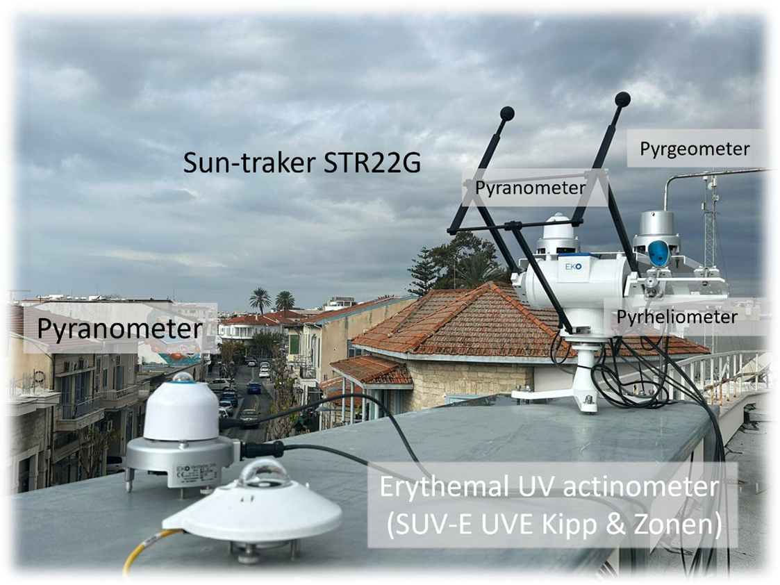
The Limassol station serves as the calibration station for the network and is equipped with advanced instrumentation to measure various aspects of solar radiation. This station includes:
- A Bentham DMc150 double monochromator spectrophotometer: This high-precision instrument is used for UV/VIS spectral solar irradiance measurements across different wavelengths (280 – 600 nm).
- A radiation station: This station measures several key components of solar radiation, including shortwave downwelling irradiance components such as global, direct, and diffuse solar radiation. Additionally, it measures longwave downwelling irradiance, which is important for understanding the energy balance of the Earth’s surface.
- Erythemal UV irradiance measurement: This specific measurement focuses on the UV radiation relevant to human skin and eye health, providing valuable information for assessing potential sunburn and other UV-related health effects.
- A sky imager: The sky imager is used to monitor cloud coverage, allowing for a better understanding of how cloud conditions impact solar radiation and aiding in the prediction of solar energy generation under varying weather conditions.
- A calibration system: To ensure the accuracy and reliability of measurements, the station employs a calibration system with three PTB Transfer Standard Lamps. These lamps serve as traceable standards and are used for the calibration of the spectrophotometer, maintaining the high quality of the measurements.
The other four stations (Polis Chrysohous, Kyperounta, Athalassa, and Frenaros) primarily provide measurements of global shortwave downwelling irradiance and erythemal UV irradiance. This distributed network of stations offers a comprehensive assessment of solar conditions in various regions of Cyprus, making it a valuable resource for researchers and organizations interested in solar energy and UV radiation monitoring in the area.
Equipment for the Agriculture sector
A recent open procurement procedure (Q3 2023) for the acquisition of the Agriculture equipment of the ERATOSTHENES Centre of Excellence has been issued on September 2023. All necessary legislative steps were followed such as market research, preparation of detailed specifications and drafting of tender documents. The tender submission has been planned for the October 2023.
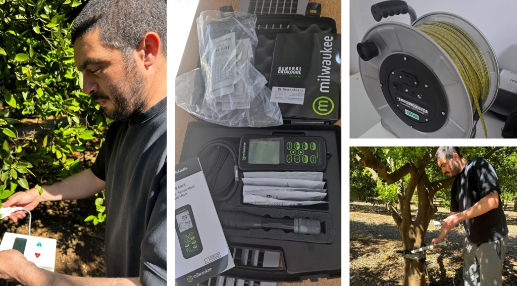
Field and laboratory equipment for the Agriculture applications
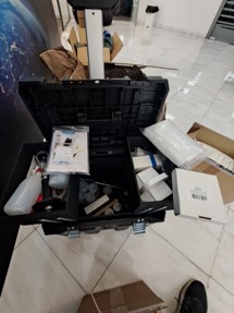
- The field and laboratory equipment purchased after an open tender procedure of the tender 019/2023 “Agricultural equipment” on 20/10/2023 for measuring basic soil – water – plant parameters (hydraulic conductivity, soil texture and water potential, soil pH, leaf area index, leaf stomatal conductance, groundwater level).
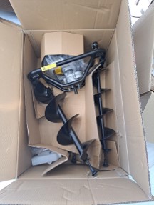
- Additional field equipment purchased after an open tender procedure of the tender 014/2024 “Agricultural equipment II” on 20/10/2023 for further enhancing the soil – water – plant measurement capabilities. The equipment includes soil moisture and soil water potential sensors, sap flow sensors, earth auger, undisturbed soil sampling kit, meteorological sensors, the CARBONICA field toolkit, soil respiration and actual evapotranspiration systems.
Geodetic equipment
A new open procurement procedure for the acquisition of the Geodetic equipment of the ERATOSTHENES CoE (Q4 2023) is being prepared. In this stage, the market research has been concluded and the Specification Committee is preparing the detailed specifications according to the requirements of “The 2016 law on the coordination of the procedures for the award of public contracts for supplies, works and services and for related issues, 73(I)/2016”. This tender it is planned to be finalized and issued by the end of October 2023.
Field and laboratory equipment for the Environment and Climate department
The field and laboratory equipment for the Environment and Climate department was purchased after two open tender procedures, of the tenders 019/2023 “Agricultural equipment” (March 2023) and 018/2024 “Agricultural equipment II” (March 2024). This equipment is dedicated for measuring basic soil – water – plant parameters, mainly for the activities (living labs, project implementation, research excellence, potential applications, and services) of the Environment and Climate Department. Depending on their use, each equipment was grouped in three main categories, which are laboratory equipment, field equipment and sensor network. A brief description of the equipment per category is given below:
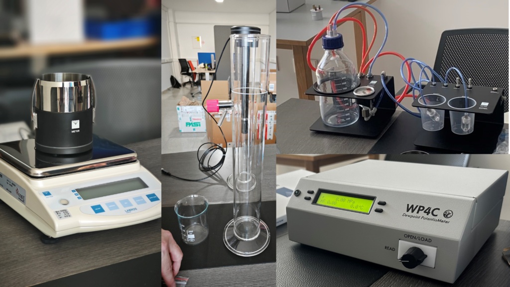
Laboratory equipment
The Laboratory equipment measures basic soil and hydrological parameters which are essential for the proper characterization of a soil sample. Besides the characterization of the parameters, which will provide essential insights for assessing current conditions and practices across the fields, the resulting information will serve as an important tool for integrating ERATOSTHENES CoE’s laboratory measurements with remote sensing data. The laboratory equipment includes an automated hydrometer for soil texture analysis, a water potential measuring system, saturated and unsaturated soil hydraulic conductivity measuring system.
Field equipment
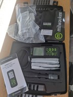
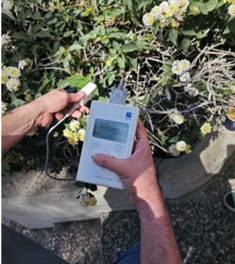
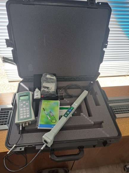
The field equipment offers basic information on key ecohydrological parameters which is deemed essential for the establishment of the agricultural living labs and other research pilot sites. The resulting information will play a crucial role in linking ERATOSTHENES CoE’s in-situ measurements and soil sample collection with remote sensing data. This integration will enhance the accuracy and reliability of large-scale assessments, enabling more informed decision-making for sustainable land management and agricultural practices. The field equipment includes a plant canopy analysis system for leaf area index measurements, porometer for stomatal conductance measurements, a multiparameter probe (pH, EC, TDS and temperature) and soil sampling equipment.
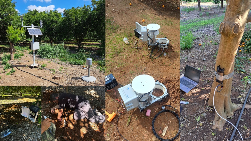
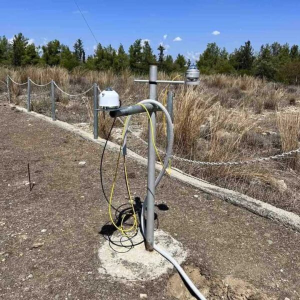
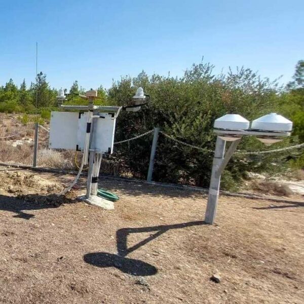
Sensor network
The sensor network includes all the sensors installed at research sites for long term observations on key environmental variables. By establishing a sensor network to monitor key parameters such as soil moisture, soil water potential, soil respiration and meteorological conditions, ERATOSTHENES CoE is strengthening Cyprus’s capacity for environmental monitoring and climate adaptation. The continuous data flow will enhance the Centre’s ability to provide accurate and robust services by integrating in-situ and remote sensing data. Additionally, this initiative will support the development of a comprehensive monitoring framework, which will be crucial for securing future funding opportunities through research and innovation activities.
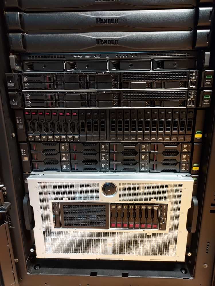
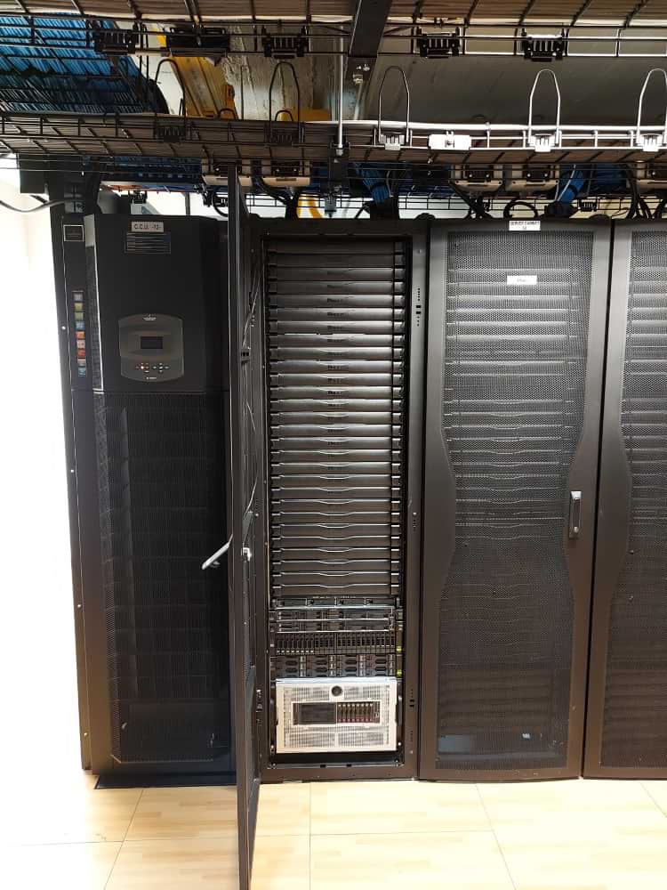
Computing Cluster infrastructure
The ERATOSTHENES Centre of Excellence (ERATOSTHENES CoE), is establishing its computing and server infrastructure at the CUT Data Centre. Specialized servers and workstations were included in the procurement.
An open tender procedure was carried out successfully. The contract signed and the equipment was installed successfully.
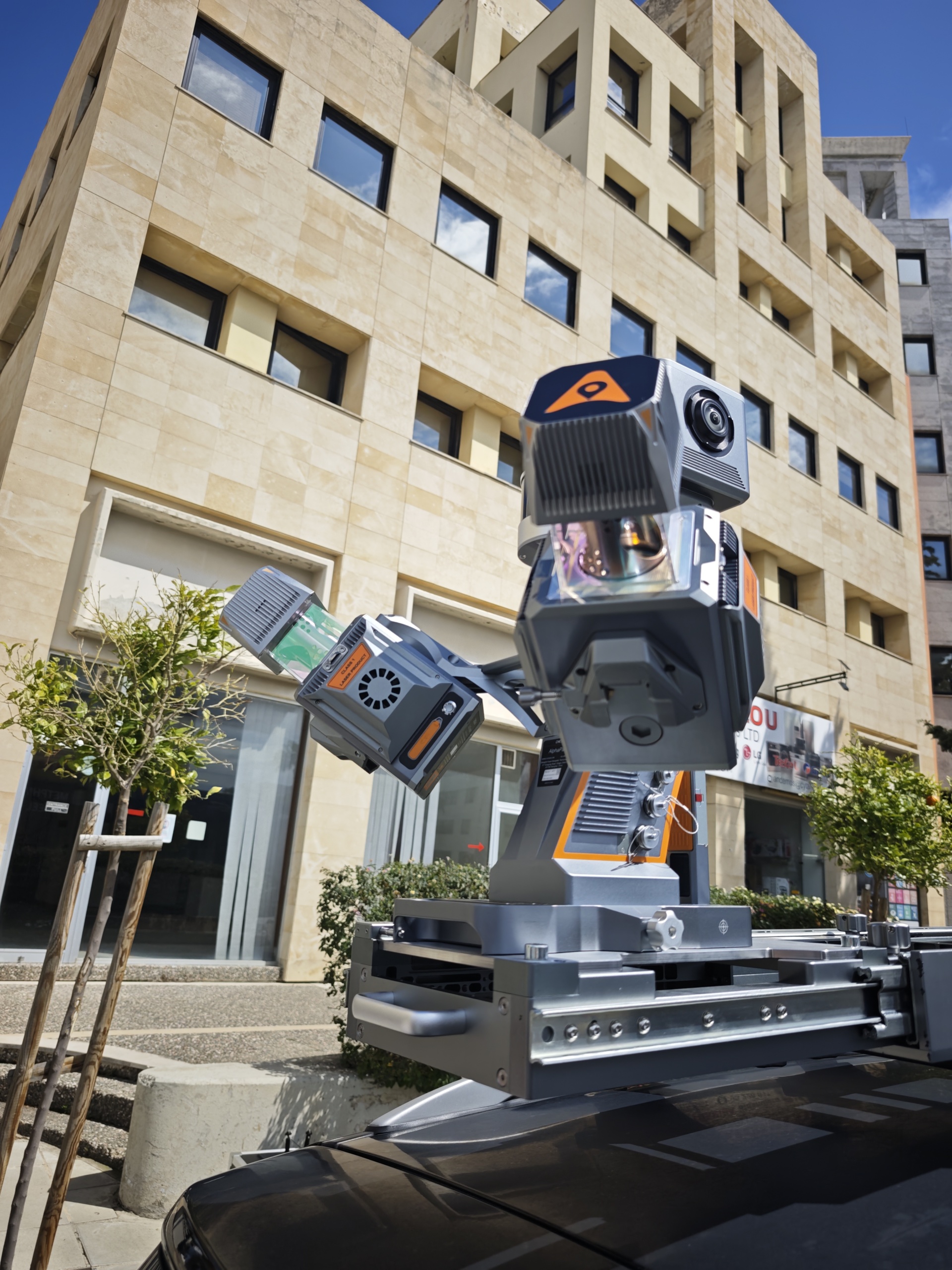
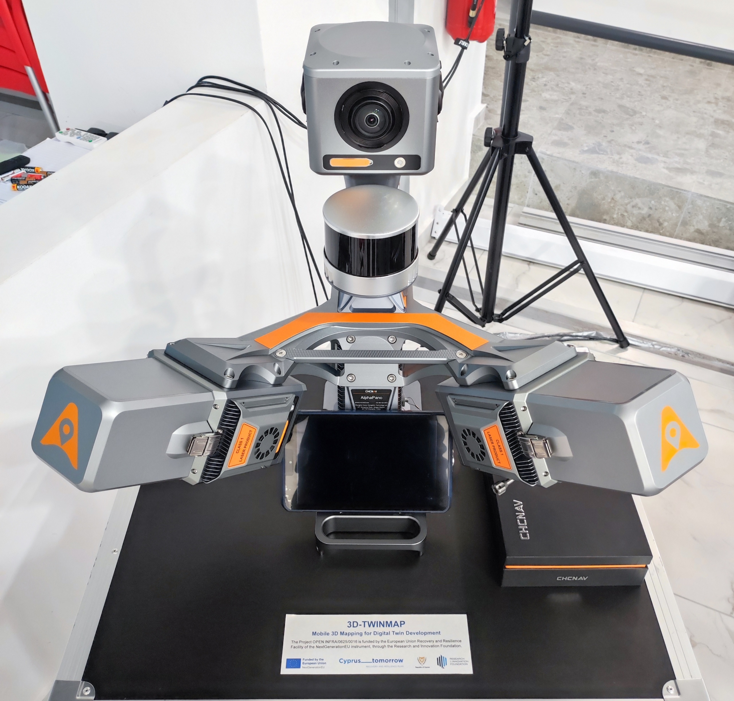
Mobile 3D Mapping System
The specific infrastructure was acquired through the project 3D Mobile Mapping for Digital Twin Development (3D-TWINMAP) that aims to establish a state-of-the-art mobile 3D mapping capability within the ERATOSTHENES Centre of Excellence (ECoE) to support the creation and use of Digital Twins in Cyprus. The project focused on the acquisition and operational deployment of a high-precision, AI-powered mobile mapping system capable of rapidly capturing dense 3D geospatial data across large-scale built environments.
The Project OPEN INFRA/0625/0016 is funded by the European Union Recovery and Resilience Facility of the NextGenerationEU instrument, through the Research and Innovation Foundation. It consists of the following components:
CHCNAV AU20 Mobile Mapping System (MMS)
The CHCNAV AU20 MMS is a high-precision mobile mapping system designed for vehicle-mounted applications. Its advanced LiDAR, High Resolution camera, SLAM, GNNS receiver, and AI-powered algorithms capture accurate 3D spatial data while streamlining field-to-office workflows. The system supports flexible sensor configurations for a wide range of applications from road surveying and infrastructure management to reconstruction and as-built verification.
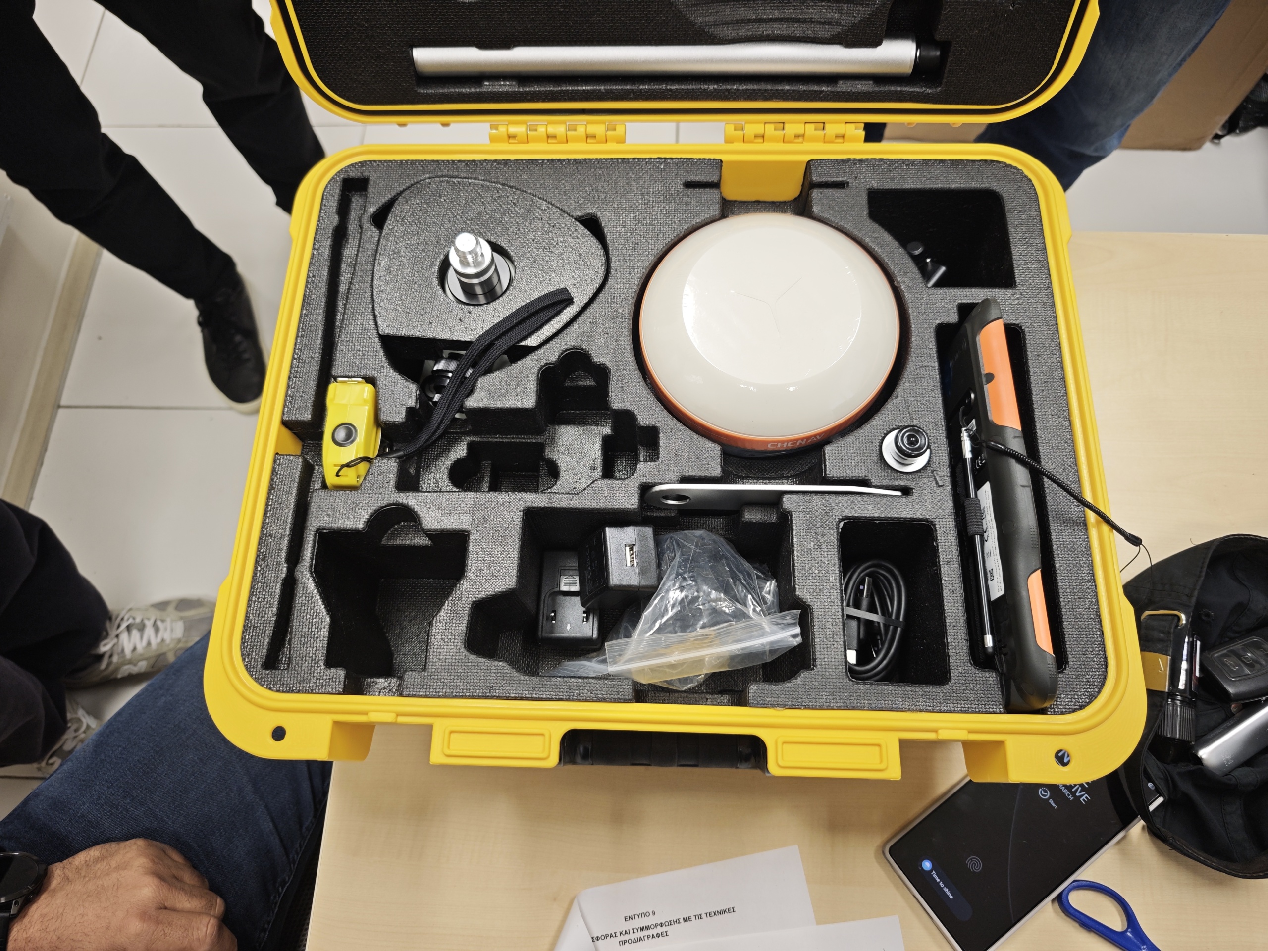
CHCNAV i83 GNSS Receiver
The i83 GNSS receiver is a powerful IMU-RTK GNSS solution built for surveying, construction, and mapping professionals. Equipped with Wi-Fi, Bluetooth, NFC, UHF, and a 4G modem, it delivers versatile connectivity across multiple applications. Its power management allows 34 hours of continuous RTK rover operation, ensuring reliable performance for extended fieldwork.
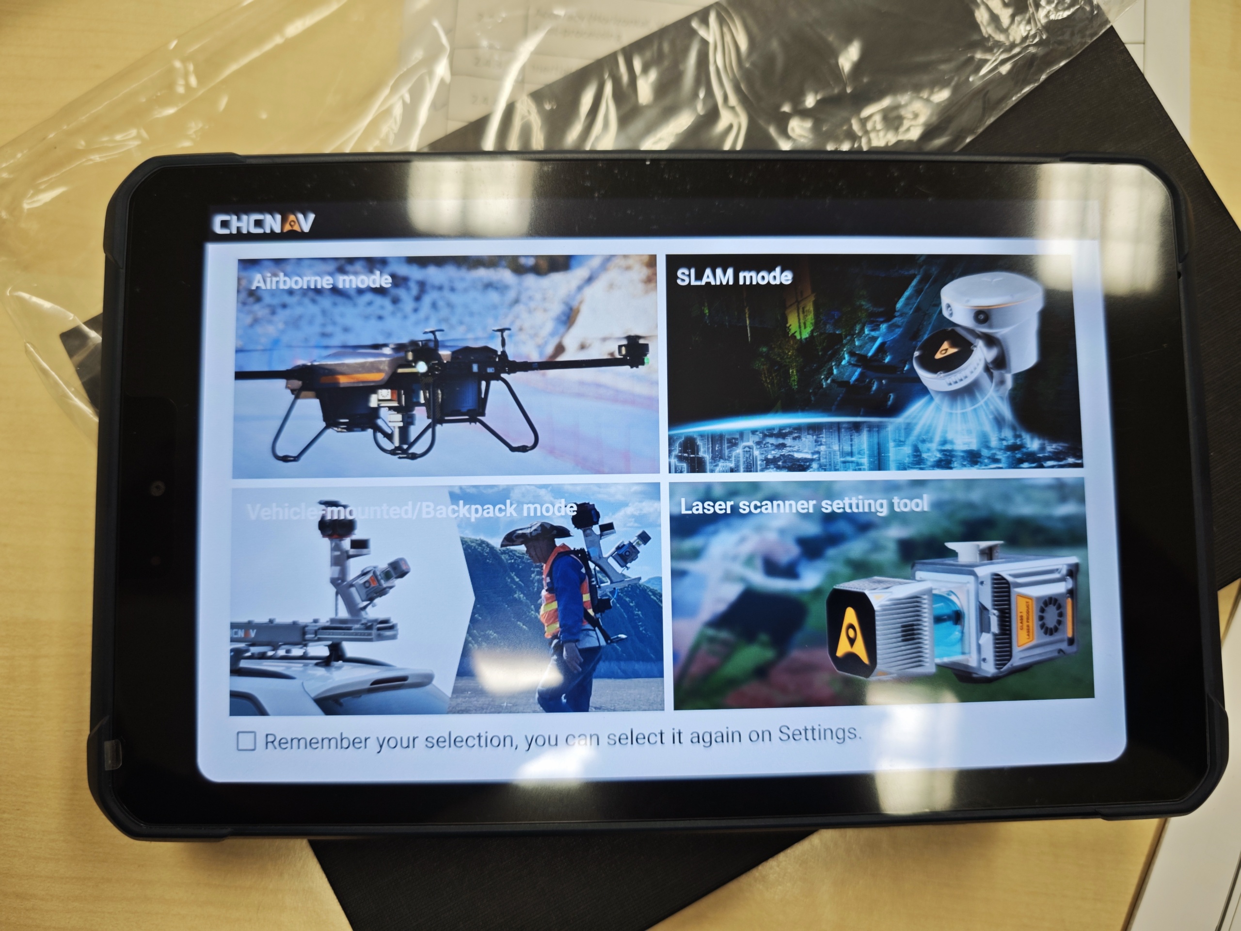
CHCNAV LT800 tablet
The LT800 Rugged Professional Android Tablet increases the efficiency and productivity of mobile workforces engaged in tasks requiring meter-level GNSS positioning accuracy and consistent performance. Its 8.1″ sunlight-readable display ensures that GIS data maps and images are easily viewed even in bright lighting conditions. Built to withstand the rigors of daily field use in harsh environments, the LT800 is the first choice for field teams facing tough conditions.
CHCNAV CoPre Processing Software
CoPre is a comprehensive LiDAR processing software developed by CHCNAV for efficient and accurate mobile geospatial data processing. It offers a range of functionalities, including trajectory processing, point cloud and image georeferencing, colorization, filtering, and Digital Ortho Model (DOM) generation. CoPre supports all CHCNAV LiDAR systems and enhances the quality and accuracy of post-processing tasks, making it an indispensable tool for geospatial professionals.
CHCNAV CoProcess Software
CoProcess, developed by CHCNAV, is a powerful software solution tailored to the post-processing of massive point cloud data. It seamlessly processes field-captured LiDAR data into a variety of multi-format deliverables. With features such as point cloud management, measurement tools, and advanced visualization, CoProcess is an essential tool for professionals in urban planning, infrastructure development, and more.
CHCNAV LandStar 8 Data Collection Software
LandStar 8 is a trusted data collection app for Android devices and CHCNAV controllers, streamlining high-precision surveying and mapping with easy-to-use workflows and an intuitive graphical interface. It includes all necessary surveying functions such as construction surveying, control point measurements, CAD support, and efficient stakeout of points, lines, and surfaces. Compatible with industry-standard data formats for seamless import and export, LandStar 8 ensures immediate productivity gains.
Use our infrastructure upon request through the Research Infrastructures platform of the Deputy Ministry of Research, Innovation and Digital Policy (https://cri.gov.cy/en/research-infrastructures-database/information-science-and-technology/94/mobile-3d-mapping-system). Information on terms of use, cooperation and fees is provided upon request. All such information is defined in a collaboration agreement.
Use our infrastructure upon request
Terms of use
Information on terms of use, cooperation and fees is provided upon request. All such information is defined in a collaboration agreement.
- Dr. Andreas CHRISTOFE
- Infrastructure Coordinator
- andreas.christofe@eratosthenes.org.cy
- +357 25002908
